Internet-based aerial photography software such as Microsoft Virtual Earth already allows fleet managers to see where their vehicles are on actual roads, rather than just on maps.
But technology improvements will mean cars and vans can be ‘watched’ driving through a three- dimensional landscape.
Eventually, thanks to satellite cameras, fleet managers will be able to spot parking spaces for their drivers, warn them of problems ahead and give them personalised directions such as ‘turn right after the building with the blue roof and before that post box’.
Telematics firm Masternaut is already offering a product using Microsoft Virtual Earth, with the position of vehicles overlaid on the photographs.
Fleet managers are able to see landmarks such as individual buildings in business parks, giving drivers even more information on their surrounding environment.
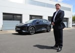
Martin Port, managing director of Masternaut UK, said: ‘It is an exciting development. Virtual Earth provides real-world detail for our users, filling in the gaps left by traditional street mapping.
‘It is easy to use, easy to interpret and takes our online vehicle management to another level.’ But a spokesman for Masternaut said this was just the beginning. In two or three years’ time, it should be possible, using a combination of precise satellite measurements of heights of buildings and street furniture and aerial photography, to create a three-dimensional ‘virtual map’ of the UK.
Actually watching cars traveling along from satellites is further off, he said, but with the military already using this technology on the battlefield, it is only a matter of time before it filters into everyday fleet practice.


Login to comment
Comments
No comments have been made yet.