
Plans are underway for a network of drone ‘Superhighways’ to link major towns and cities across the UK.
A consortium, led by Unified Traffic Management (UTM) software provider Altitude Angel, has already submitted plans for a 165-mile route connecting airspace above cities including Reading, Oxford, Milton Keynes, Cambridge, Coventry, and Rugby.
If the plans are approved there is an option to extend the superhighway to Southampton on the south coast and Ipswich on the east coast.
The blueprint for the superhighway, known as Project Skyway, will enable businesses to develop and grow through the commercialisation of new and innovative drone-based products, processes, and services.
A decision on whether to green light the project is expected in the coming weeks.
“This is the most ambitious transport project proposed for the country since the advent of the railway network in the 18th century,” said Richard Parker, Altitude Angel, CEO and founder.
Unlike existing drone corridors or research facilities which restrict access to operators by imposing punitive financial barriers to fly, the superhighway will be able to support fully automated drone flights from any drone company which completes a series of basic technical integrations.
Parker added: “Britain is at the forefront of a second transport revolution. Drones have the potential to transport goods in a way our ancestors could never have imagined but would have surely understood. Britain can lead the world in these innovative and life-saving technologies, we have the skills and ambition to open our skies to safe and secure drone and air-taxi flights.
“With the government’s support, using this technology as its foundation, we can create networks spanning the length and breadth of Britain, a super-highway-network-in-the-sky, providing a critical digital infrastructure which will, in-turn, enable the world’s first truly national drone economy.”
The UTM will enable flight requests, approvals, deconfliction and provides a single-source-point-of-truth for all traffic on the Project Skyway corridors through combined manned and unmanned situational awareness. Project Skyway makes this combined air picture available to larger groups of airspace users through existing solution providers, such as those providing existing planning and tracking products to commercial air transport.
Once the initial UK highway is established, Altitude Angel will make the technology available via a licencing agreement, to allow any organisation, airport, town, or to operate a ‘superhighway’.
More articles on:
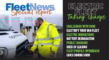 Fleet News looks in detail at how you can start the journey to van electrification and speaks to those already well advanced in their transition about the innovative ways they overcome some of the problems.
We also bust myths about batteries and look at the technologies poised to come to market promising greater range and faster charging.
Openreach head of sustainability Abby Chicken explains how the UK's largest commercial fleet is managing the transition to electric, and we also look at 10 of the best electric car and van models due to come to market this year.
Enjoy the read
Steve Briers
Group editor
Fleet News
Read now
Matt has been an automotive journalist for nine years and has driven just about every new car and van that's on sale. As content editor - vehicles he is responsible for the automotive content on Fleet News and also contributes to Automotive Management. Prior to this, Matt worked in the automotive industry for 10 years.


Login to comment
Comments
No comments have been made yet.