
Transport for West Midlands (TfWM) has partnered with crowdsourced sat-nav app, Waze, as part of a two-way data sharing initiative to help reduce congestion.
TfWM is using Waze’s real-time data to 'act on new hotspots of traffic' on its road networks, filling in blind spots which they can’t monitor alone across the Key Route Network (KRN).
While TfWM monitors routes and journey times, it can now track performance against the Waze calculated norm, enabling the organisation to gain a better understanding of how the highway network is functioning on a daily basis so they can equip drivers with real-time insights to help optimise their travel.
Mark Corbin, director for network resilience at Transport for West Midlands (TfWM), said: “This partnership has been significantly invaluable to us, in helping TfWM to understand road network performance, disruptions, and utilising real data to support our wider management of the transport system, and ensuring our residents and businesses are kept informed.”
Waze said through TfWM's partnership with the app and the Waze for Cities program, TfWM can analyse data across from the highway network to help reduce congestion, increase road safety, and speed up journey times.
The TfWM team can also coordinate with the local highway authorities and National Highways to identify collisions, congestion and disruption, enabling it to better prioritise its response to any incidents by tracking irregularities across the network, it said.
The use of Waze’s data within the Regional Traffic Coordination Centre (RTCC) is part of a project to help reimagine transport in the West Midlands.
Waze said the partnership will help improve communications to people moving around the region and ensure drivers receive real-time information about their journeys to help inform their driving decisions.
Ru Roberts, country manager at Waze UK, said: “Partnering with Transport for West Midlands means we can understand more about the specific challenges they face - from reducing congestion caused by incidents and improving safety for residents and visitors, to providing access to mobility alternatives and sustainable transport options across their highway networks.
“More importantly, this means we can better support drivers in the region by sharing reliable data about journey times, advance notice on construction and road closures, and real-time updates on incidents affecting their route.”
Fleets can hear how MaaS can fit within their future decarbonisation strategy as this year's Fleet & Mobility Live, taking place next week on October 11 and 12 at the NEC, near Birmingham. Register for free now.
More articles on:
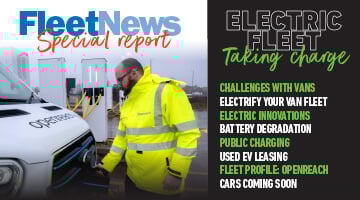 Fleet News looks in detail at how you can start the journey to van electrification and speaks to those already well advanced in their transition about the innovative ways they overcome some of the problems.
We also bust myths about batteries and look at the technologies poised to come to market promising greater range and faster charging.
Openreach head of sustainability Abby Chicken explains how the UK's largest commercial fleet is managing the transition to electric, and we also look at 10 of the best electric car and van models due to come to market this year.
Enjoy the read
Steve Briers
Group editor
Fleet News
Read now
Jessica is event and digital content co-ordinator for all our events.
She was the web producer at Fleet News, Commercial Fleet and Smart Transport until April 2023.
She started her career as a content writer for a digital marketing agency that specialised in financial services, where she worked for more than two years.
Jessica was awarded the degree of Bachelor of Arts with Honours in Multimedia Journalism in 2017.


Login to comment
Comments
No comments have been made yet.